← All projects
Satellic: public toll calculator for Belgian truck tolling
Replicating the on-board unit's pricing logic so hauliers can estimate the cost of a route before they drive it.
2019
in production, continuously maintained since
Replicating the on-board unit's pricing logic so hauliers can estimate the cost of a route before they drive it.
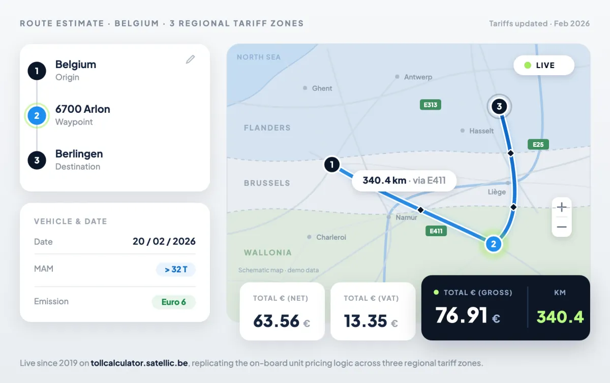
Satellic operates Belgium's national truck-tolling system. It needed to replace an aging legacy simulator with a public-facing web tool that lets a haulier estimate the toll for a route before driving it. The hard part was fidelity: the figure shown online had to match what the on-board unit (OBU) actually charges on the road. That meant replicating the OBU pricing logic exactly, across the country's three regional tariff zones (Flanders, Brussels, Wallonia), and accounting for tariffs that change over time. On top of that, the interface had to be simple enough to cut the support complaints the old tool generated.
We built tollcalculator.satellic.be as a public web application with two layers working together: a Google Maps visualisation for route and waypoints, and a pricing engine that mirrors the OBU billing logic. A PostGIS database handles geolocation and the regional boundaries, while a full tariff history is stored so the tool can run both retrospective and prospective calculations as rates evolve. Users enter their origin, destination and intermediate stops through Google Autocomplete, set the gross vehicle weight and emission class, and get an itemised estimate with service points shown on the map.